Visualizing urban development patterns by age can reveal a lot about the evolution of a city, historically and up to the present day. To state the obvious, historic preservation is a very hot topic in Miami right now. Miami’s most historic neighborhoods are not coincidentally many of its most popular, presenting a need for preservation, a public desire to preserve what makes those neighborhoods special to begin with, and inherent challenges to that preservation. Cities are also built in very different ways than they were in the past. Greater Miami is, of course, no exception to this rule, although development happens a little differently everywhere. By using data from the Miami-Dade Property appraiser, Gridics has mapped urban development across the entire county by decade constructed in shades of blue, allowing patterns of growth to be seen in the data.
Visualizing urban development patterns by age can reveal a lot about the evolution of a city, historically and up to the present day. To state the obvious, historic preservation is a very hot topic in Miami right now. Miami’s most historic neighborhoods are not coincidentally many of its most popular, presenting a need for preservation, a public desire to preserve what makes those neighborhoods special to begin with, and inherent challenges to that preservation. Cities are also built in very different ways than they were in the past. Greater Miami is, of course, no exception to this rule, although development happens a little differently everywhere. By using data from the Miami-Dade Property appraiser, Gridics has mapped urban development across the entire county by decade constructed in shades of blue, allowing patterns of growth to be seen in the data. To interact with the maps yourself, go to the Property Records map view, and turn on the ‘Age of Property by Dacede’ layer in the upper right corner.
In these maps, lighter shades of blue indicate older properties, while dark indicates newer. The range is from 1891 to the present day. Looking at Greater Downtown Miami (above), larger, more-recently constructed projects cluster along the waterfront, spreading north and south of Downtown, interspersed with more lightly developed older lots. Museum Park and Margaret Pace Park, which both relatively recently underwent major overhauls, stand out, while development around them–in the form of park-lining condominium towers–is also newer. The urban core of Downtown Miami, along Flagler Street and Miami Avenue, is a strong node of very historic architecture from the early decades of the 20th century, while great swaths of older, relatively modest housing stock expand to the west in Little Havana and Shenandoah.

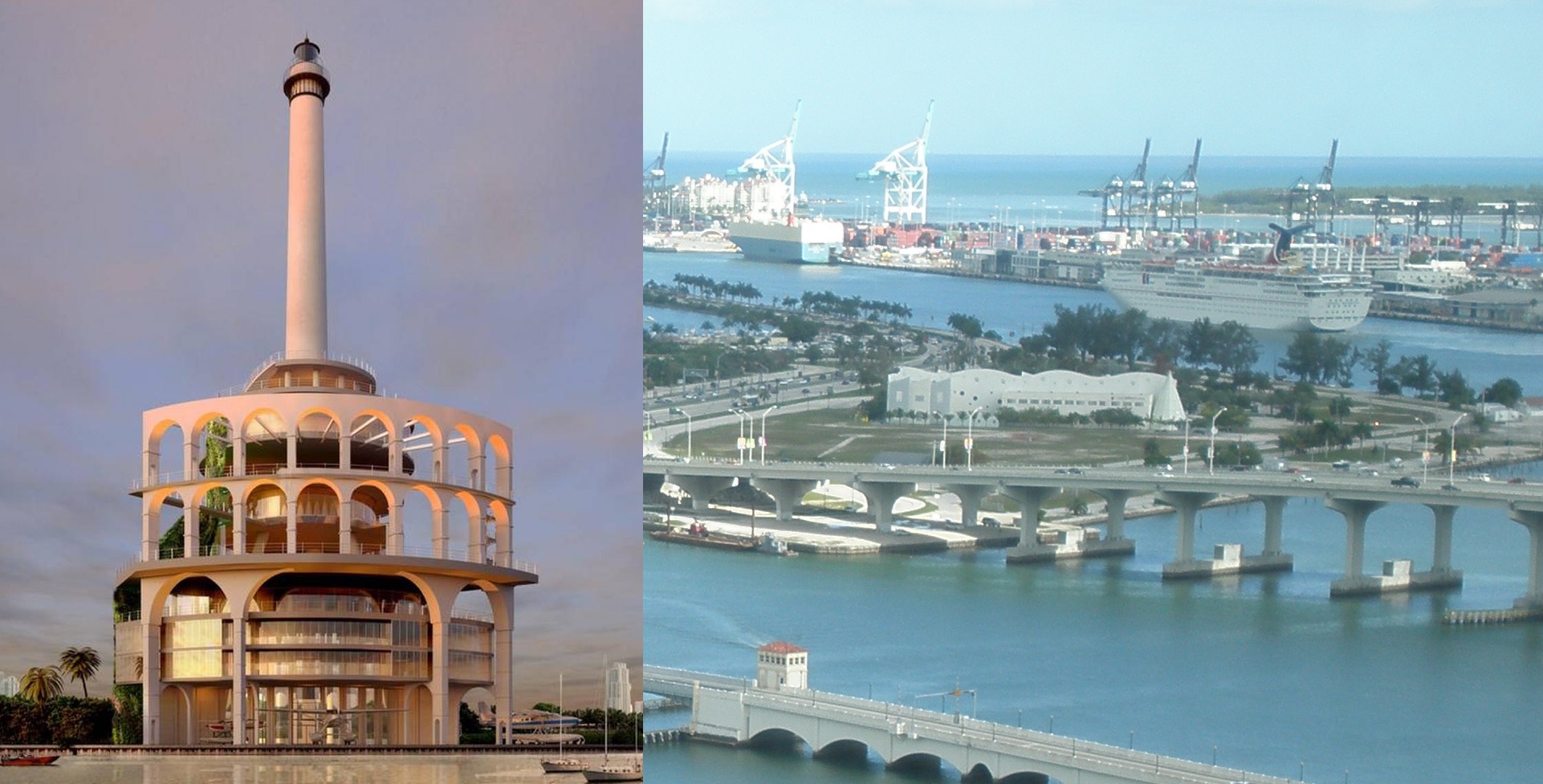
Over in South Beach, another of Miami’s most historic areas, the historic consistency of the Art Deco District (see the Miami Beach Architectural District), built predominantly in the 1920s, ’30s, and ’40s, fills the heart of the peninsula. Newer, larger buildings from the 1950s and ’60s and so on line the west, Biscayne Bay side. Ocean Drive’s historic integrity is generally protected, while a large area of much newer oceanfront construction exists on the blocks to the north. Below Fifth Street, where historic protections were slower to arrive and more of the original, early-20th century building stock was unceremoniously demolished, buildings get newer. The southern tip of the beach, which is lined by gleaming condominium towers, is a very dark blue not from the aquiline waters of Government Cut and the Atlantic Ocean but because they were almost entirely built in recent decades. This was the former home of the Miami Beach Kennel Club, a dog racing track demolished for its land.

The Upper East Side is a good example of an area of older Miami single-family and dense but low-scale commercial. Along the bay, a row of affluent single family neighborhoods is interrupted by a few pockets of mid and high rise residential development. Areas where lighter shades of blue are more uniform are the historically designated neighborhoods of Morningside, Buena Vista, etc. while neighborhoods around them hold buildings of more varied ages. Bay Pointe, just to the south of Morningside Park, has larger lots on curvilinear streets. It was developed more recently than its surroundings, and is not historically protected. Meanwhile, just to the west you can see higher density and more recent commercial and residential construction along Biscayne Boulevard and in the Design District, where a new outdoor shopping district is being created.

Although Coconut Grove is one of Miami’s oldest neighborhoods, much of what is considered ‘the Grove’ today is quite new. Older, smaller historic areas are centered in the western reaches of the neighborhood, including the historically Bahamian ‘West Grove,’ which is Miami’s oldest black neighborhood, and extend south along Main Highway. Newer condominium and hotel developments sprouted up on large South Bayshore Drive lots extending northeast, looking over park land and the historic Dinner Key Seaplane Base, now used as Miami’s City Hall.

In Mid-Miami Beach, moving from the Atlantic Ocean to Biscayne Bay gives a cross section of development, and ‘desirability’ of the island city. To the east, the oceanfront is lined with condominium and hotel towers on large lots. Although this strand along Collins Avenue is within an historic district (the Morris Lapidus Mid-20th Century Historic District) it is interspersed with more contemporary buildings edging in for an ocean view wherever space allows. Across Indian Creek to the west are mostly single-family neighborhoods. The largest lots, along the water, contain the most splendid historic homes. Many were built in the 1920s, ’30s, and ’40s. They are also, of course, the most at risk of replacement. These historic, single family neighborhoods of Nautilus and La Gorce are being ringed by large, much more recently built homes on the best lots, and loosing their biggest architectural statements in the process.

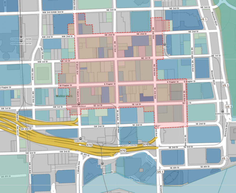
Back downtown, new development is happening predominantly just to the north and south of the urban core, in Park West and Brickell in Park West and south in Brickell, as well as along the river. Despite not being locally protected (a National Register of Historic Places designation does not stop demolitions) the central business district is retaining much of its old architecture. The map below illustrates the district boundaries. Redevelopment has come, however, to Biscayne Boulevard, replacing many of the old hotels that once lined the street. Miami River urban renewal in the 1970s and ’80s created a line of large scale development that has continued eastward to the condo towers, hotels, and apartment buildings built at the mouth of the Miami River in the last real estate boom as well as the present day. To the west, the large medium-dark blue blocks are the result of additional urban renewal schemes that created the Miami-Dade county Government and Cultural Centers. They will soon be accompanied by the MiamiCentral rail station megaproject.